


Voting District 0002, Bosque County, Texas
About
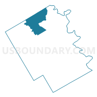
Outline

Summary
| Unique Area Identifier | 670952 |
| Name | Voting District 0002 |
| County | Bosque County |
| State | Texas |
| Area (square miles) | 72.73 |
| Land Area (square miles) | 72.12 |
| Water Area (square miles) | 0.61 |
| % of Land Area | 99.16 |
| % of Water Area | 0.84 |
| Latitude of the Internal Point | 32.08352180 |
| Longtitude of the Internal Point | -97.73671220 |
Maps


Graphs
Select a template below for downloading or customizing gragh for Voting District 0002, Bosque County, Texas


Neighbors
Neighoring Voting District (by Name) Neighboring Voting District on the Map
- Voting District 0001, Bosque County, TX
- Voting District 0002, Somervell County, TX
- Voting District 0003, Bosque County, TX
- Voting District 0004, Bosque County, TX
- Voting District 0004, Somervell County, TX
- Voting District 0006, Bosque County, TX
Top 10 Neighboring County Subdivision (by Population) Neighboring County Subdivision on the Map
- Glen Rose CCD, Somervell County, TX (8,490)
- Meridian CCD, Bosque County, TX (6,532)
- Iredell CCD, Bosque County, TX (974)
Top 10 Neighboring Place (by Population) Neighboring Place on the Map
Top 10 Neighboring Unified School District (by Population) Neighboring Unified School District on the Map
- Glen Rose Independent School District, TX (8,417)
- Meridian Independent School District, TX (2,597)
- Walnut Springs Independent School District, TX (1,298)
- Morgan Independent School District, TX (968)
- Iredell Independent School District, TX (952)
Top 10 Neighboring State Legislative District Lower Chamber (by Population) Neighboring State Legislative District Lower Chamber on the Map
Top 10 Neighboring State Legislative District Upper Chamber (by Population) Neighboring State Legislative District Upper Chamber on the Map
Top 10 Neighboring 111th Congressional District (by Population) Neighboring 111th Congressional District on the Map
Top 10 Neighboring Census Tract (by Population) Neighboring Census Tract on the Map
Top 10 Neighboring 5-Digit ZIP Code Tabulation Area (by Population) Neighboring 5-Digit ZIP Code Tabulation Area on the Map
- 76043, TX (7,071)
- 76665, TX (2,526)
- 76671, TX (1,777)
- 76690, TX (1,197)
- 76652, TX (1,087)
- 76649, TX (790)